 Internet


Fotos recientes de la Antártida
El invierno desciende sobre la Antártida una vez más y, después de una cargada temporada para científicos y turistas, muchos investigadores residentes en este continente viajan al norte en esta estación. Ellos nos traen imágenes recientes que se exponen en esta galería fotográfica a gran formato.
| Use j/k keys or ←/→ to navigate • Choose: |
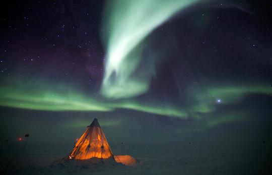
The aurora australis provides a dramatic backdrop to a Scott Tent at Amundsen-Scott South Pole Station on July 14, 2009. (National Science Foundation/Patrick Cullis) 

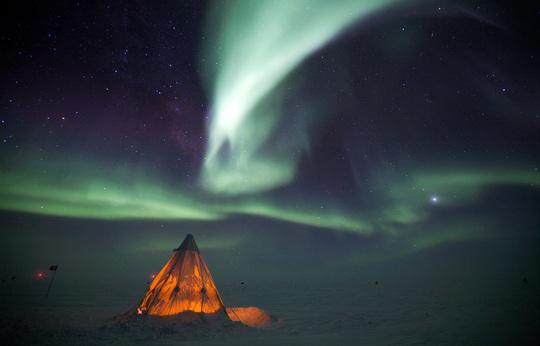
The aurora australis provides a dramatic backdrop to a Scott Tent at Amundsen-Scott South Pole Station on July 14, 2009. (National Science Foundation/Patrick Cullis)
 </a>
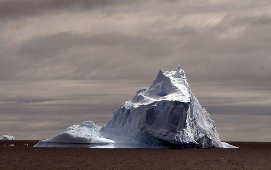
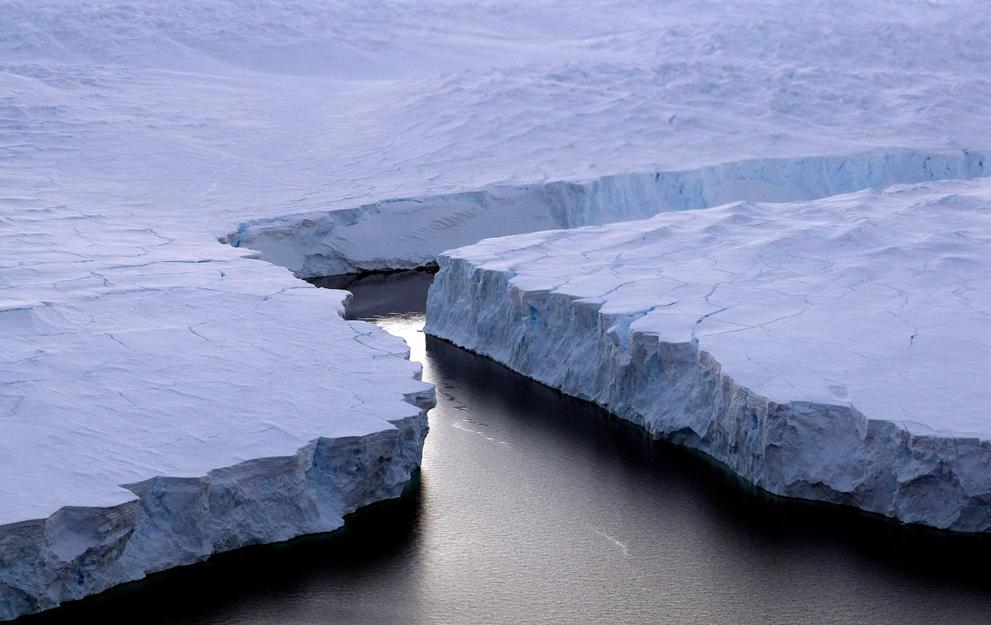
A large iceberg floats off the coast of Antarctica, seen on January 1st, 2010. Original here. (Ben Stephenson / CC BY) # 

 </a>
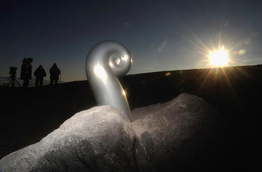
The Koru Memorial site at Scott Base on February 15, 2011 in Antarctica. The New Zealand government flew family members of the victims of the Mount Erebus tragedy to Scott Base to remember those who lost thier lives. 257 passengers and crew were killed on November 28, 1979 when an Air New Zealand Antarctic sightseeing flight collided with Mount Erebus on Ross Island, Antarctica. (Ross Land/NZPA-Pool/Getty Images) # 

 </a>
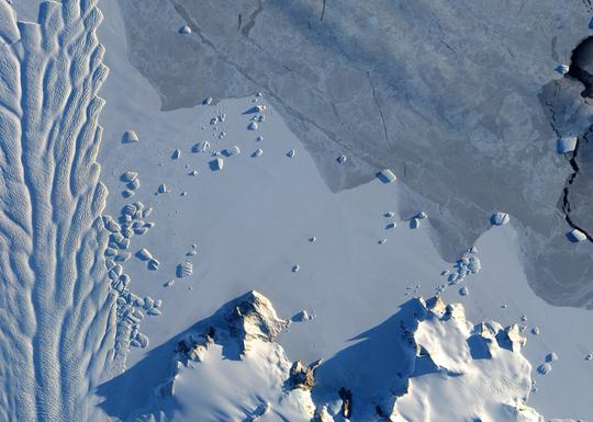
The Matusevich Glacier flows toward the coast of East Antarctica, pushing through a channel between the Lazarev Mountains and the northwestern tip of the Wilson Hills. Each of the smaller blocks measure nearly one kilometer across. After passing through the channel, the glacier has room to spread out as it floats on the ocean. On September 6, 2010, the Advanced Land Imager (ALI) on NASA's Earth Observing-1 (EO-1) satellite captured this natural-color image. (NASA Earth Observatory/Jesse Allen and Robert Simmon) # 

 </a>
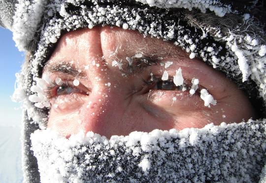
South Pole 'fuelie' Rose Meyer gets pretty cold when performing her job fueling airplanes at Amundsen-Scott South Pole Station on October 26, 2010. The warmest temperature recorded that week at Pole was -37.1C (-34.8F) and the coldest temperature was -50.2C (-58.4F). (National Science Foundation/Kristina 'Kricket' Scheerer) # 

 </a>

 </a>

 </a>
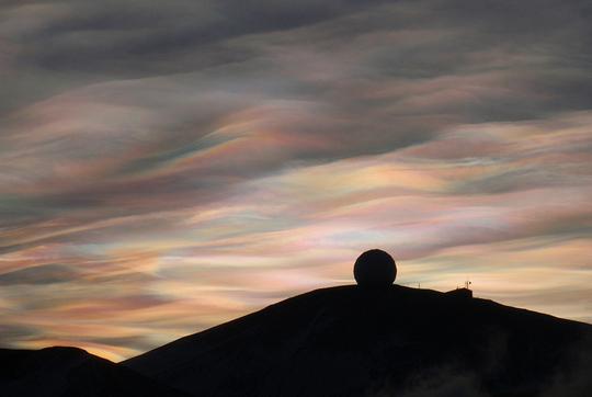
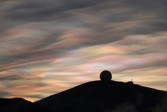
Nacreous Clouds over the NASA Radome (a weatherproof structure housing a 10 meter antenna inside). Nacreous clouds (or Polar stratospheric clouds) form high in the dry stratosphere, catching sunlight well after dusk, displaying brilliant colors. Original here. (Alan R. Light / CC BY) # 

 </a>
 </a>


 </a>
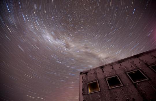
A 20-minute exposure reveals the southern celestial axis above the new elevated station at Amundsen-Scott South Pole Station on July 21, 2009. At the poles, scientists can study a fixed point in the sky for months and years, whereas in the middle latitutes the stars 'move' across the night sky. The white cloudy streak is the Milky Way. (National Science Foundation/Patrick Cullis) # 

 </a>

 </a>
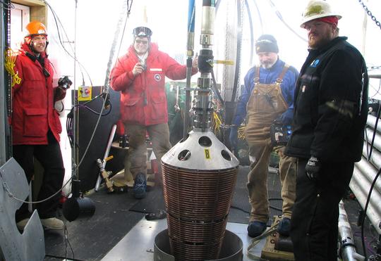
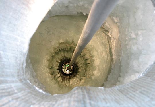
Construction of the IceCube Neutrino Observatory takes place as a Firn Drill is lowered into the Antarctic ice. The Firn Drill melts its way through an upper layer of compacted snow (approximately 50 meters thick) to the solid Antarctic ice below - when another, enhanced hot water drill takes over to drill 2,500 meters further down. (National Science Foundation)# 

 </a>
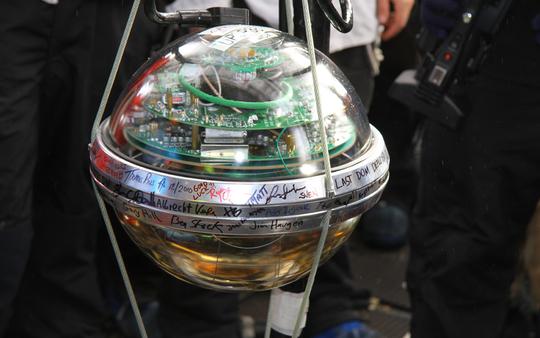
The last Digital Optical Module (DOM) deployed in the IceCube array. This is the last of the 5,160 DOMs deployed on 86 different "strings", suspended in ice some 1,400 meters below the surface, forming an array of neutrino detectors occupying one cubic kilometer. (National Science Foundation/R. Schwarz)* # 

 </a>

 </a>
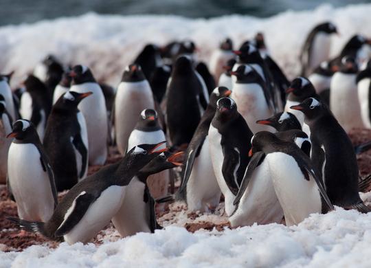
Gentoo penguins squabble in their colony in Antarctica on November 24th, 2010. Photographed as part of a fundraiser/trip titled the Penguin Project. Original here. (pinguino k / CC BY) # 

 </a>
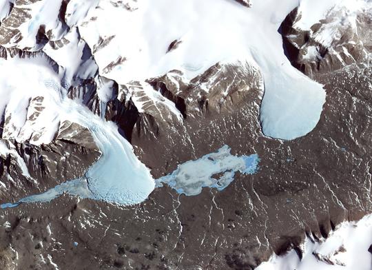
A series of parallel valleys lie between the Ross Sea and the East Antarctic Ice Sheet, known as the Dry Valleys. They are swept free of snow by nearly relentless katabatic winds -cold, dry air that rolls downhill toward the sea from the high altitudes of the ice sheet. In the center is frozen Lake Fryxell, near Canada Glacier, to the left. Image acquired November, 2000. (NASA/Jesse Allen, NASA/GSFC/METI/ERSDAC/JAROS, and U.S./Japan ASTER Science Team) # 

 </a>

 </a>
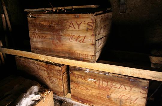
In this handout photo taken Friday, Feb. 5, 2010 and provided by Antarctic Heritage Trust Monday, Feb. 8, 2010, Crates of Scotch whisky and two of brandy are seen after they have been recovered by a team restoring an Antarctic hut used more than 100 years ago by famed polar explorer Ernest Shackleton. (AP Photo/Antarctic Heritage Trust) # 

 </a>
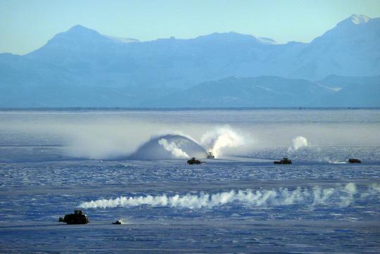
Heavy equipment operators work to clear snow and smooth the annual sea ice near McMurdo Station, creating a landing strip in this photo taken September 24, 2009. The first C-17 jet of the austral summer landed on this runway with passengers and cargo on September 29, kicking off another season of scientific research for the US Antarctic Program. (National Science Foundation/Lori Gravelle) # 

 </a>

 </a>
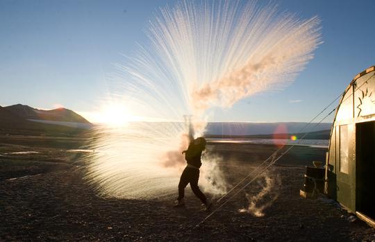
Long Term Ecological Research (LTER) field team member Anna Bramucci throws hot water into the air to watch it turn to ice crystals and vapor on a -25 F (-32 C) day at Lake Fryxell field camp in Taylor Valley, Victoria Land on March 30, 2008. (
http://www.theatlantic.com/infocus/2011/03/recent-scenes-from-antarctica/100019/

por [BkN]XeNoMoRPH
04 Mar 2011, 23:38
04 Mar 2011, 23:38
Activos en INET
Los más activos en Curiosidades
Subforos
-
Internet
- Ayuda
- Call of Duty 2
- Call of Duty 4
- Company of Heroes
- Competiciones
- Counter-Strike
- Counter-Strike: Source
- Curiosidades
- FEAR
- Final Fantasy
- General
- Juegos
- Medal of Honor
- Pro Evolution Soccer
- Quake
- Quake 3 Arena
- Redes y Conexiones
- Soldier of Fortune 2
- Street Fighter IV
- Unreal Tournament
- Unreal Tournament 2004
- Unreal Tournament 3
- Warhammer 40k: Dawn of War
- Wolfenstein: Enemy Territory
La 11 es bestial, me gustan todas
Qué bonito, joder S:
La 2 es simplemente espectacular, pero todas están muy muy bien.
Como me gustaria ir ahí… A lo Jesus Calleja
estan muy bien
abrigate bien
La 11 es para fondo de escritorio
como molan esas nubes:
Eso no es granada, peludo?
a mi también me gustan todas, pero hablemos de la Antártida…
Como molan!
Impresionante
Madre mia hay cada una que no veas. La 11 es muy buena
Muy buenas muy pero my buenas!!!
la 22 se va a tener que quitar rapido si no quiere que le caiga granizo